
Bexar County ZIP Code Coverage
The county’s live GIS ZIP layer is a spatial cross-check. Its PO_NAME field is a postal label, not a full neighborhood boundary, a physical post-office location, or a delivery promise. The representative rows below come from that official layer rather than an attempt to list every code that touches Bexar County. Use the USPS result for a specific mailing address.
| ZIP | Areas covered | Post office | Notes |
|---|---|---|---|
| 78201 | San Antonio postal area | San Antonio | Current GIS polygon row; validate an address with USPS. |
| 78210 | San Antonio postal area | San Antonio | Current GIS polygon row; not a city-limit boundary. |
| 78220 | San Antonio postal area | San Antonio | Current GIS polygon row; map date matters. |
| 78230 | San Antonio postal area | San Antonio | Current GIS polygon row; delivery must be checked by address. |
| 78240 | San Antonio postal area | San Antonio | Current GIS polygon row; the GIS service is not delivery validation. |
| 78150 | JBSA Randolph postal area | JBSA Randolph | Installation and postal label, not evidence about any person. |
| 78234 | JBSA Ft Sam Houston postal area | JBSA Ft Sam Houston | Installation and postal label, not a resident classification. |
| 78236 | JBSA Lackland postal area | JBSA Lackland | Installation and postal label, not a resident classification. |
Other Bexar County codes use postal labels such as Atascosa, Helotes, Converse, Universal City, Saint Hedwig, and Somerset. Some current polygons also carry names associated with places outside the county. A postal name can help route a search, but it does not settle county jurisdiction or city limits.
Bexar County Postal Map Fields
The Bexar GIS ZIP layer supports spatial and ZIP queries. It returns polygons and centroids, which makes it useful for comparing an address area to a county map. It is not an address-specific postal lookup. The layer metadata has older update notes, so preserve the map source and query date when recording a result.
| Layer field or control | Type | What it contributes |
|---|---|---|
| ZIP | Postal code field | Identifies the polygon’s five-digit ZIP label. |
| PO_NAME | Postal-name field | Supplies the layer’s postal place name, not a complete neighborhood list. |
| STATE | State field | Labels the state associated with the GIS feature. |
| SQMI | Area field | Gives a mapped-area attribute, not a delivery service guarantee. |
| Lng, Lat, Shape | Centroid and geometry fields | Place the feature on a map and support spatial comparison. |
| Query and pagination | Layer controls | Allow a narrow ZIP or geometry query rather than a broad address conclusion. |
The layer’s fields describe geography. They do not supply a current postal assignment, an all-address directory, or a ZIP-wide voter or property browse.
The Bexar GIS ZIP layer displays the county polygon fields used for this postal map cross-check.
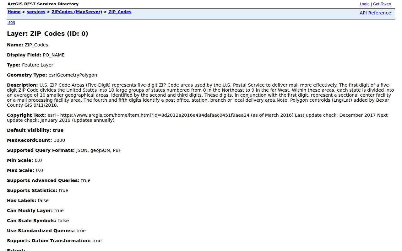
This county GIS view is best used to see which polygon a map point meets. Verify a mailing ZIP with USPS before relying on it for a form, correspondence, or records query.
Verify a Bexar County Mailing ZIP
Finding records within one Bexar County ZIP starts with postal validation, then moves through location and record type. The research did not find a confirmed ZIP-wide BCAD browse or a ZIP-wide public voter browse. Both omissions matter because a ZIP label alone is too broad to establish a parcel, a jurisdiction, or an individual match.
- Enter the full delivery address in the USPS ZIP Code Lookup and retain the returned postal ZIP as the address-specific result.
- Compare that ZIP with the Bexar GIS ZIP polygon and confirm the parcel’s city, ETJ, or unincorporated context.
- Use BCAD by address, owner name, or property ID to locate the parcel. Do not treat the property search as a confirmed ZIP-wide listing tool.
- When an individual voter check is necessary, use the required date of birth, house number, and last-name flow rather than trying to build a ZIP-wide list.
- Once the ZIP is narrowed to an address, use the Bexar County street directory for the parcel, deed, permit, and dated-address workflow.
The USPS result is the last word for delivery validation. The GIS map is the county geography check, and BCAD or the County Clerk supplies the relevant property or instrument path.
The USPS ZIP Code Lookup is the address-specific source shown below.
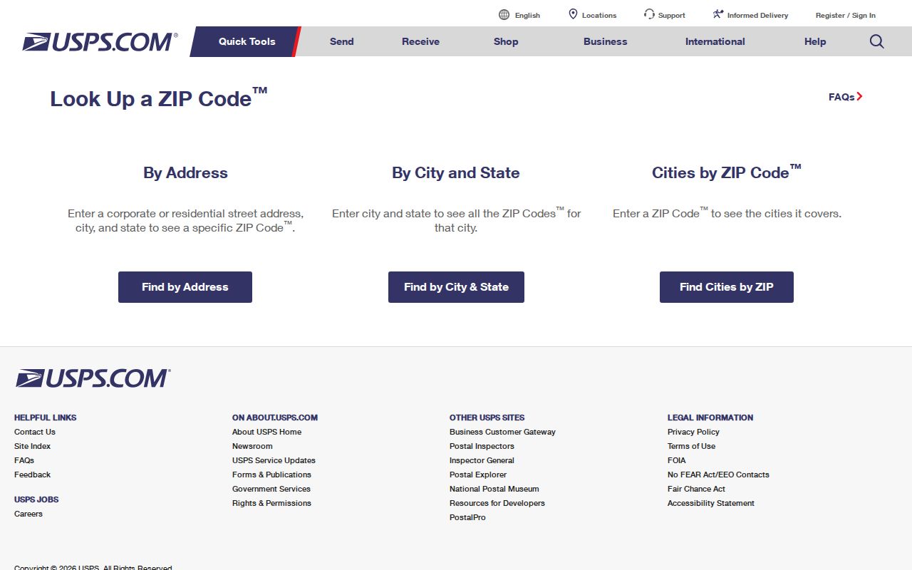
The USPS tool ties a ZIP result to the entered address. That distinction prevents a map polygon or a postal city name from being mistaken for a delivery decision.
Bexar County Record Paths by ZIP
A Bexar County ZIP directory search can guide the next official source, but the actual record key changes by system. BCAD uses owner name, address, or property ID. The parcel GIS layer uses a map feature and PropID. The County Clerk’s official records portal uses a department selector, search term, and recorded-date filters, with Index Only and OCR choices. Each source is more precise when it begins with an address, a legal description, an instrument number, or a person-specific field.
The BCAD property search and parcel GIS layer can connect a confirmed address to the situs, legal description, and property identifier. The Bexar Official Records Search can then be used with the legal description, grantor or grantee, subdivision, document type, document number, and a narrow date range. Keep the ZIP as a location aid, not the sole research key.
Note: Save the search date and the source identifier because property, map, and postal data can change independently.
Bexar County Postal-City Mismatches
Postal ZIP boundaries and incorporated city limits answer different questions. Bexar County includes unincorporated pockets, San Antonio’s ETJ, edge municipalities, military installations, and postal-city labels. An address can carry a San Antonio ZIP while lying outside San Antonio city limits, or have a non-San Antonio postal name while still being within Bexar County. Compare the USPS result, parcel jurisdiction, and city GIS, council, or annexation map before selecting a municipal office.
- ZIP versus ZIP+4
- A ZIP identifies a postal area. ZIP+4 adds a more specific delivery segment and should come from the USPS result for the exact address.
- PO Box ZIP
- A ZIP used for post-office boxes. It describes a mail service category, not the physical location of a parcel.
- Unique ZIP
- A ZIP associated with one organization or delivery arrangement. It is a postal label, not a finding about the people connected to that institution.
- Carrier route
- A postal delivery grouping within an area. It is not a municipal boundary, a census unit, or a resident roster.
Census ZCTAs are statistical geography and should not replace USPS validation. The current GIS polygon is helpful for a map comparison, but neither source establishes city jurisdiction by itself.
Bexar County Postal Names
The military labels in the current layer are a useful local reminder that postal geography is not a residency finding. 78150 is labeled JBSA Randolph, 78234 is labeled JBSA Ft Sam Houston, and 78236 is labeled JBSA Lackland. Treat each as an installation or postal-geography clue only. Do not infer a person’s connection to an installation from a ZIP label.
Outside the 782-series, the current county GIS result includes postal labels associated with Atascosa, Boerne, Castroville, Helotes, La Coste, Mico, Poteet, Rio Medina, Somerset, Adkins, Converse, Elmendorf, Universal City, and Saint Hedwig. Several labels point toward regional geography that can cross a county or city line. This is why a current USPS answer and a parcel jurisdiction check belong before choosing a Bexar County or San Antonio records office.
Bexar County ZIP Search Limits
No official current ZIP split or realignment year was found in the inspected sources. No official per-ZIP population or voter-registration table was found either. The Bexar voter application is an individual lookup, not a ZIP-wide public search. BCAD confirms address, owner-name, and property-ID entry points, but the research did not confirm a ZIP-wide property browse. Avoid filling those gaps with estimates or a list assembled from unrelated records.
The county ZIP layer supports geographic and ZIP queries, while the precinct finder accepts either a street name or ZIP code for address-range and side-of-street information. The two tools have different purposes. A precinct result can assist with election geography, but it does not provide a ZIP-wide directory of registered people.
Note: When a requested ZIP statistic or broad record set is not located in official sources, state that limit and retain the narrower official search path.
Bexar County ZIP History Checks
An older San Antonio exhibit titled “ZIP CODES FOR BEXAR COUNTY AND ADJACENT COUNTIES” preserves additional codes and adjacent-county context that the live GIS query does not return. It should be read as a historical and special-code cross-check, not as a current delivery table. The exhibit’s adjacent-county scope is itself a warning against treating every code printed on a regional map as a Bexar County ZIP.
When a map, an old exhibit, and a postal result disagree, use a simple evidence order: USPS for the exact current address, the Bexar GIS layer for the county polygon, and the older exhibit only to flag a historical or regional difference. Record the map or source date beside each finding.
Bexar County Postal Boundaries and Privacy
A ZIP is broad geography. It should not be used to create a list of people or to infer who belongs at a home, an installation, or a protected location. Voter records can be suppressed under Texas protections, and BCAD web suppression affects only its website display. A protected or redacted field is a limit, not a prompt to reconstruct information from nearby records or alternate spellings.
Lawful use. Use Bexar County postal and record tools for personal, lawful research and address verification. Do not use public data to stalk, harass, intimidate, or expose protected address information.
For a record correction, contact the custodian that maintains the source. For postal delivery questions, use USPS; for a BCAD display issue, use BCAD; and for voter-record questions, contact Bexar Elections.