
Bexar County Block Records
Official sources describe the block from different angles. The parcel layer maps lots and their visible attributes. BCAD displays appraisal information for a property. The voter application is an individual search, not a block roll. San Antonio’s association registry supplies community contact and boundary context, while city maps can show dated place layers. None of these sources makes a verified household roster.
| Source | What It Shows About a Block | Access |
|---|---|---|
| Bexar parcel GIS | Nearby parcel geometry, PropID, situs, and mapped attributes | Public map or query; approximate and not a survey |
| BCAD | Displayed owner label, situs or mailing fields, values, and property details | Property search, counter, or PIA route; suppression caveats apply |
| Bexar voter search | One registered address and precinct result when inputs match | Individual lookup only; protected results may be hidden |
| San Antonio association registry | Voluntary group contacts and stated boundaries | Public registry, not a member list |
| City downloadable maps | Neighborhood, council, annexation, and place context | Map layers; boundary date matters |
The owner label on a parcel can differ from the people who receive mail there, and both can differ from a voter registration record. Keep each observation in its own column or note. Adjacent parcels are a map relationship, not a claim about relationships between people.
Bexar County Parcel Records
The Bexar parcel layer exposes fields that make a block search repeatable. Useful fields include PropID, Situs, Owner, address lines, Zip and Zip4, LglDesc, land and improvement values, neighborhood, gross building area, year built, room count, exemptions, property use, and geometry. PropID is the practical stable key for moving from the map to a property record. Situs is the location the record associates with the parcel, while LglDesc is its legal description.
The official Bexar parcel layer shown here is a field-oriented map resource. A blank, suppressed, stale, or generalized field is not permission to supply a value from another source. BCAD notes that a current tax year is generally the most current appraisal view, and a recorded deed can take time to appear in appraisal data.
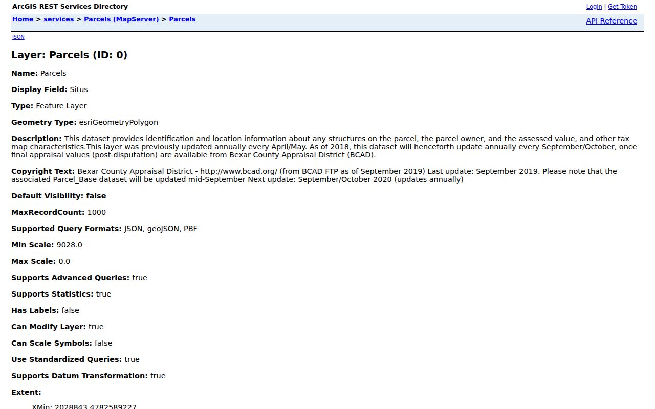
Write down the PropID, situs, and layer date before comparing parcels. That compact record lets another searcher reproduce the map query without turning a nearby lot into a people profile.
- PropID
- The parcel identifier displayed by the Bexar GIS layer.
- Situs
- The location address associated with the property record, which can differ from a mailing address.
- Geometry
- The mapped shape and position of a parcel. It shows place, not a legal survey result.
Map Bexar County Block Records
The useful parcel method is a short, auditable chain. First resolve the subject address, then identify its parcel. Compare the surrounding parcel shapes rather than relying on a map label alone. Retrieve the nearby PropIDs and situs values, and only then inspect each property record independently. This separates map adjacency from a conclusion about an owner or occupant.
- Geocode the address and confirm the best candidate before using the parcel map.
- Identify the subject parcel and retain its PropID, situs, and legal description.
- Compare nearby parcel geometries and note only the parcels that are actually adjacent or relevant to the stated radius.
- Retrieve each nearby PropID and situs from the layer, then check its displayed BCAD record as a separate source.
- Label every result by source date and stop if a record is protected, blank, or does not independently support the point.
For a full named-street record chain rather than an immediate block comparison, use the Bexar County street directory. Street-by-street research has a different scope from an adjacent-parcel search.
Bexar County Map Record Limits
My Bexar Community Dashboard warns that its map is approximate and is not a survey, legal description, or engineering document. That warning belongs with every parcel comparison. A lot edge shown on screen may be useful for orienting a search, but it cannot settle a boundary or ownership dispute. Use the legal description, recorded plat, or the proper custodian when the exact boundary matters.
Local jurisdiction also matters. San Antonio’s addressing route differs between the city and the extraterritorial or outside-city area, where CPS Energy assigns addresses. Bexar County includes rural roads, edge municipalities, and unincorporated places as well as San Antonio. A map label should therefore be checked against the address, parcel, and office that maintains the relevant record.
Note: A map’s visible parcel shape provides geographic context, but it does not establish a current owner, resident, boundary, or legal right.
Bexar County Precinct Records
Voter information has firm limits in a block search. Bexar’s public voter application requires a date of birth, house number, and last name for an individual result. It is not a public bulk block roll. Texas Election Code §13.004 protects specified information, and a protected record can be suppressed or represented by substitute information. Do not collect individual results into a reconstructed neighborhood list.
The Bexar Precinct Finder is different from the individual voter application. It accepts a street name or ZIP Code and returns matching streets with address ranges or blocks and odd or even sides. It gives election geography and address-range context, not a roster of people.
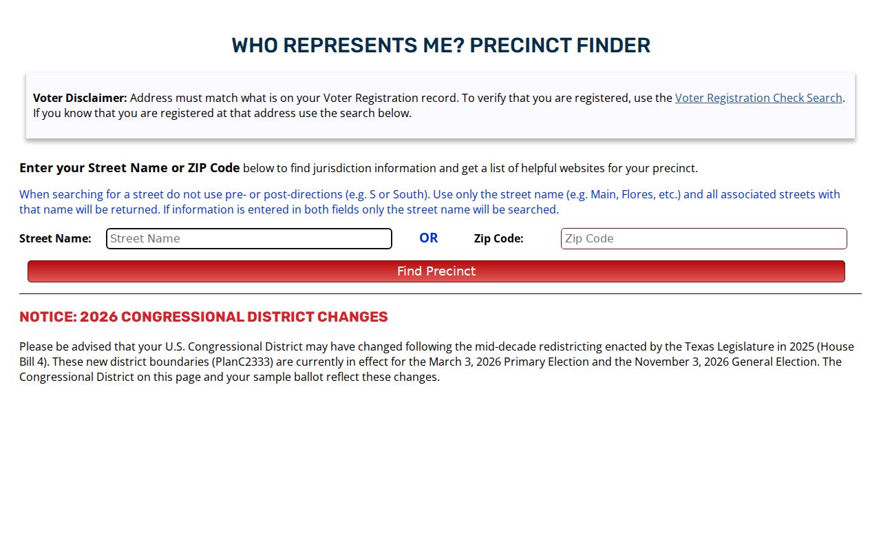
Use a precinct result to confirm the relevant election geography for an address. Save the query date because polling information and representative boundaries can change.
Bexar County Association Records
San Antonio’s Association and Organization Registry adds a community layer without pretending to identify every household. Groups register voluntarily and can provide a contact and boundary map. The City says it does not verify completeness, accuracy, or bylaws, and group boundaries can overlap. The registry is not a public roster of members, residents, or property owners.
The San Antonio Association and Organization Registry is shown below. Use it to identify a stated neighborhood, homeowner, or community group contact, then verify any boundary against the map date and the group’s own current information.

| Association record | Use and limit |
|---|---|
| Group name and contact | A point of contact, not evidence that a person lives in the area. |
| Boundary map | Community context that can overlap another group or differ from parcel lines. |
| Registry status | Voluntary participation; the City does not certify completeness, accuracy, or bylaws. |
Bexar County Dated Map Records
Neighborhood names and boundaries have histories. City downloadable maps can add council, annexation, neighborhood, and place context, but their date is part of the evidence. San Antonio’s Archive Search also holds city deeds, tax maps, engineer maps, election records, and local collections that can explain an older block name or street change. Pair a historical source with a current parcel only after comparing dates.
The City GIS downloadable maps page provides the municipal map layer starting point.
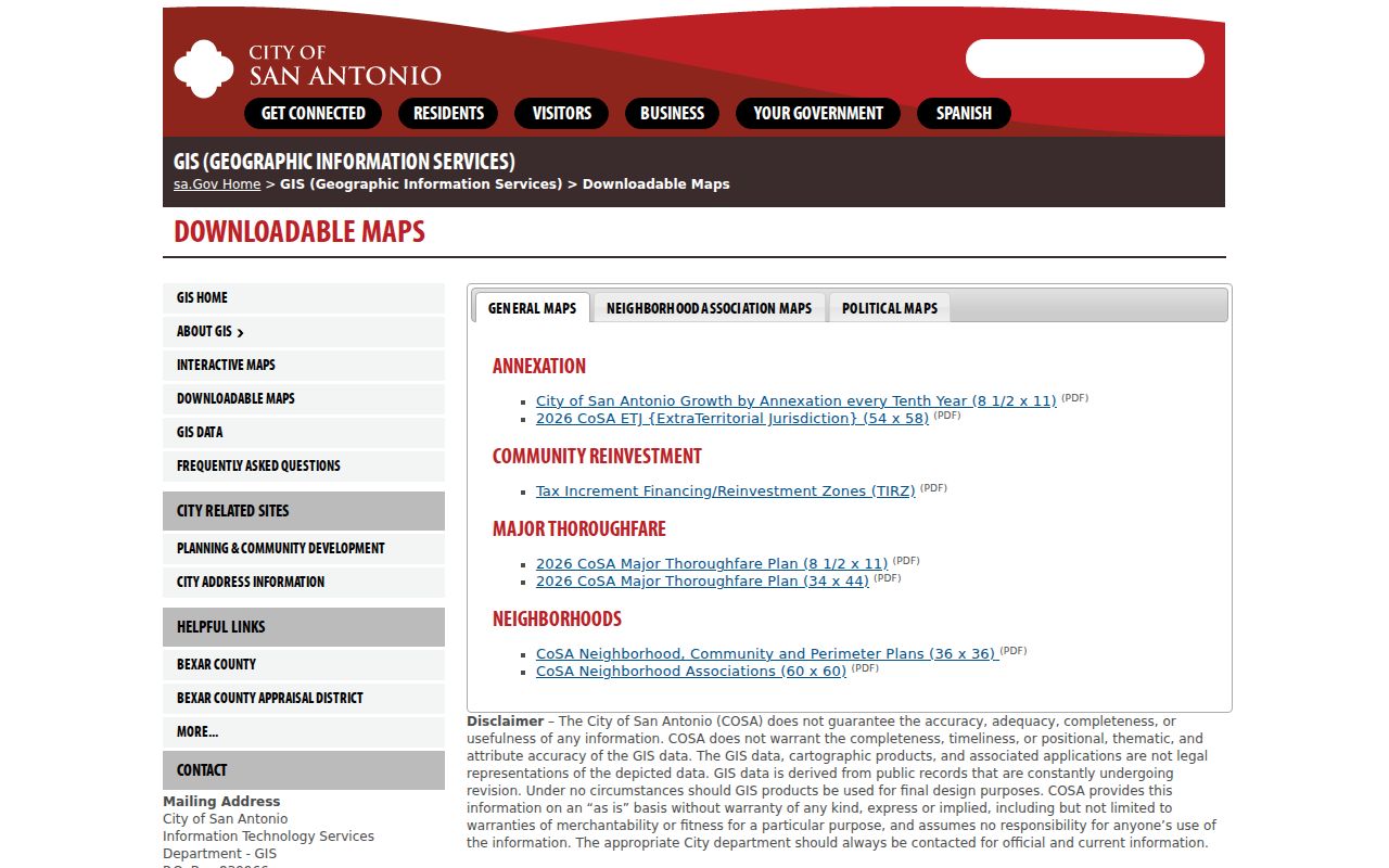
These maps help explain place names and boundary changes around a Bexar County block. They should never be used to turn a historical neighborhood label into a present household claim.
Bexar County Block Record Comparison
Official parcel and appraisal records show their custodian, field labels, and a date or tax-year context. Commercial neighbor-search categories can combine parcel, directory, and address associations, but their updates may lag and same-name people can be merged. Use a commercial result only as a lead to verify at the originating custodian. Keep the final work parcel-based and identify whether the evidence is a map, an appraisal label, a recorded instrument, or an individual voter result.
When records conflict, do not quietly choose the most recent-looking address. Compare the source date, the field label, and the record purpose. A deed can identify a recorded party, a BCAD card can display an appraisal owner label, and a voter result can reflect registration geography. Those facts may all be accurate for their dates while answering different questions. A Bexar County block search is stronger when it preserves that uncertainty instead of joining separate records into a single present-tense claim.
| Record path | Strength | Limit |
|---|---|---|
| Official parcel and BCAD records | Named custodian, visible parcel fields, and source date | Owner label and mailing fields do not prove present occupancy |
| Recorded County Clerk instrument | Dated party and legal-description evidence | A filing role does not create a current-resident claim |
| Commercial neighbor category | May suggest a record to check | Can be stale, incomplete, or merge same-name people |
Bexar County Block Privacy Records
Private block information includes household membership, protected voter addresses, utility and customer records, delivery information, and non-public school information. It should not be collected, inferred, or reconstructed. Texas address-confidentiality and voter protections can hide information, while BCAD web suppression may limit its online display without removing every public record. An absence from a result is not proof that a person is absent from the area.
When an existing county or city record is not available in a search, a carefully limited Texas Public Information Act request can ask the correct custodian for an identified record series, date range, and parcel or instrument key. It cannot require the agency to create a block roster or disclose protected material. Record the office, request date, and response before making a conclusion about the nearby parcels.
Lawful use. Use Bexar County neighbor records for personal, lawful research and place context. Do not use a parcel, map, or address result to stalk, harass, threaten, or intimidate anyone.