
Trace a Bexar County Street Directory
Resolve the address before attaching a name. For a Bexar County street directory search, the strongest route moves from delivery address to parcel, then from parcel to the recorded land trail. A BCAD owner label is property evidence, while a voter result is a tightly limited individual lookup and a criss-cross directory is a dated publication. Keep each result in its own category and record the source date. This approach also works when an address lies near San Antonio city limits, where the map, postal label, and record custodian can point to different jurisdictions.
- Validate the full address with the USPS ZIP Code Lookup, then compare it with the Bexar geocoder. Note any alternate street spelling or candidate match.
- Search BCAD by address to record the property ID, situs, owner label, legal description, and displayed appraisal fields.
- Use the legal description, grantee name, or a narrow date range in the Bexar Official Records Search to find the relevant recorded instrument and preserve its instrument number.
- When a person must be checked individually, use the Bexar voter application with the required date of birth, house number, and last name. A voter result is not a street-wide roster.
- For an earlier period, search a criss-cross directory by street and number, then read the edition and notation before treating it as a dated listing.
Save the normalized address, parcel identifier, instrument number, and publication year together. Those anchors make it possible to revisit a result without turning a mix of records into one unsupported claim.
Bexar County Street Address Crosswalk
San Antonio gives a Bexar County street search an unusual address pattern. The City Addressing page describes a grid using one address every 50 feet in increments of four. Commerce Street and the San Antonio River divide the quadrants, with odd numbers generally north or west and even numbers generally south or east. It is an orientation aid, not a survey or a substitute for a parcel boundary.
Authority changes with jurisdiction. The City Addressing Team assigns and validates addresses inside San Antonio city limits. CPS Energy handles address assignment in the city ETJ and outside city limits within Bexar County. That split matters for rural roads and fringe subdivisions. Start with postal validation, use the Bexar geocoder for a map candidate, then compare the BCAD situs and deed legal description before assuming two address forms describe the same place.
- Parcel
- A mapped property unit. The Bexar GIS layer identifies it with a PropID that can bridge a map feature to a property record.
- Situs address
- The physical location assigned to a parcel. It is different from a mailing address used for tax correspondence.
- Plat
- A recorded subdivision map that can identify a lot, block, and subdivision when a street number changes or is inconsistent.
- Criss-cross directory
- A reverse address directory that starts with a street and number, then gives a dated listing rather than a current occupancy claim.
Note: Preserve both the entered and normalized address when a rural route, old number, or renamed street produces more than one valid record path.
BCAD Fields for Bexar County Streets
BCAD offers property search by owner name, address, or property ID, plus map and plat entry points. A street directory query should treat its visible values as appraisal and property fields. A current owner label, mailing address, exemption, value, or structural field can be useful for matching a parcel, yet none of those fields alone proves present residence. The BCAD site says older records can have discrepancies, and a mailing address can differ from the situs.
| BCAD field | Use in a street search | Important limit |
|---|---|---|
| Property ID | Connects the BCAD record to a parcel feature and a saved research note. | It identifies property, not a person. |
| Situs address | Locates the parcel along the Bexar County street. | Address form can change over time. |
| Owner label | Provides a property-record name for deed research. | It is not a household list. |
| Legal description | Supplies lot, block, subdivision, or other title language for the deed index. | Read it with the recorded instrument. |
| Values and structure fields | Help distinguish similar parcels or map results. | They are appraisal data and can be approximate or stale. |
When a field appears wrong, BCAD has a help and public-information route. Its web-suppression process affects BCAD website display only, not every record maintained by other Bexar County custodians.
Bexar County Street Parcel Evidence
The Bexar County parcel GIS layer is the map-to-record bridge for a street directory search. Its schema includes PropID, Situs, Owner, address lines, Zip, LglDesc, land and improvement values, neighborhood, building area, year built, stories, room fields, acreage, tax units, exemptions, use, and geometry. Query results are limited to 1,000 records, so a narrow map area is more reliable than an attempt to create a countywide street list.
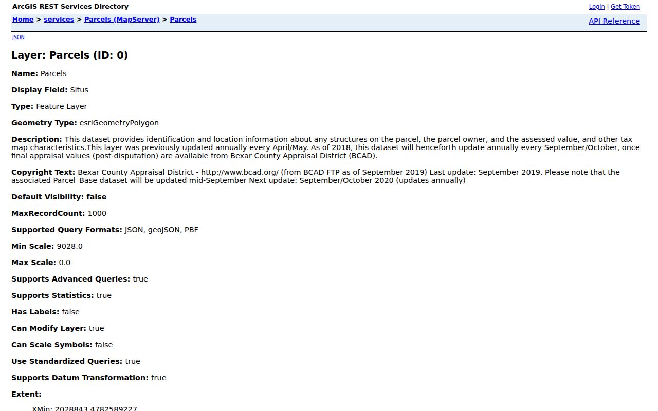
The layer is valuable because PropID and LglDesc survive address variations better than a street label alone. The map data is approximate, not a survey, legal description, or live occupancy register, so verify the parcel with BCAD and the appropriate custodian.
Use nearby parcel geometry only to orient the search. It can show mapped properties along a street, but it does not support a guessed list of people on a block.
Bexar County Street Deed Trail
The County Clerk’s recorded-instrument portal is the Bexar County street directory route for ownership history, not a modern address book. The official search has a department selector, Search Term, starting and ending recorded dates, date presets, and Index Only or Index & Full Text (OCR) modes. The search term can accept grantor or grantee names, subdivision, document type, or document number. In index-only mode, two or more words are treated as individual words; OCR can search scanned text as a phrase.
Start with the current parcel’s legal description and owner label. Find the latest relevant purchase deed, record the instrument number, date, grantor, grantee, and legal description, then search the seller as an earlier grantee. A party may be a trust, estate, organization, or attorney, so retain the role instead of describing every party as a resident. If the online portal does not reach the needed period, the County Clerk counter, deed books, TSLAC microfilm, FamilySearch catalog, or a written records request are the documented fallback channels.
For nineteenth-century work, TSLAC’s Bexar County guide documents deed records from 1837 to 1889 and warns of missing or unfilmed volumes. The official online index start year was not located in the inspected sources.
Bexar County Street Permit Dates
Permit history can place a project at an address, but it does not identify a current occupant. San Antonio’s Legacy Permit Portal covers issued permits from April 2003 through November 2020, with a limited earlier 1998 through 2003 batch. Later records are routed through BuildSA. For an address search, Legacy controls include A/P number, type, name, street number, direction, street name, suffix, city, first five ZIP digits, parcel, parcel key, and processed-date range.
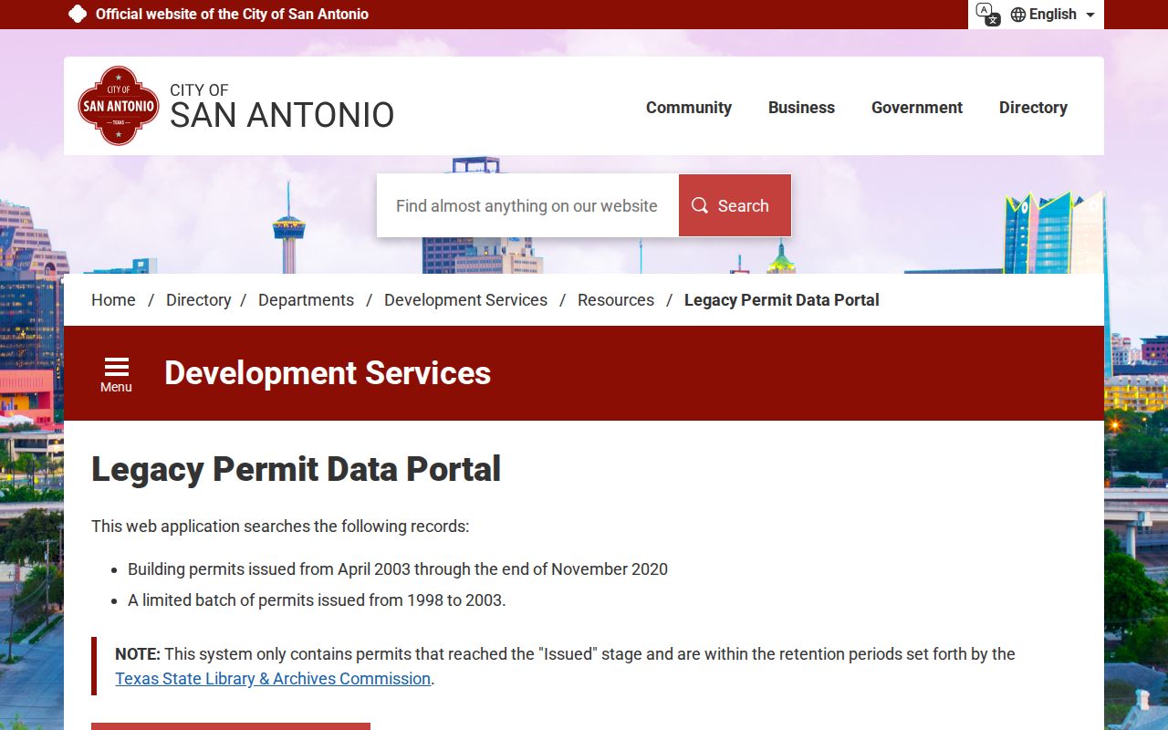
Use the permit date and address as a project clue, then keep the named role as displayed. When no complete public code-enforcement case search is available, the documented route is 311 or a request for an existing record under the Texas Public Information Act.
Note: A permit, notice, or contractor field may establish a recorded project or role, not a current connection to the address.
Bexar County Street Precinct Checks
The Bexar Precinct Finder accepts a Street Name or ZIP Code and returns matching streets with address ranges or blocks and odd or even sides. If both inputs are supplied, the street controls. That makes it a useful geography check after an address has been normalized. It is not a resident roster, and its address must match the voter record.
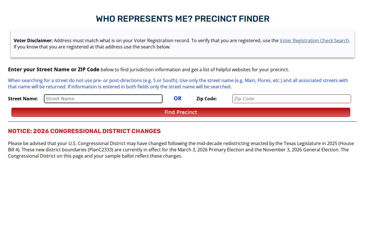
To verify one person, the separate Bexar Voter Registration Search requires date of birth and house number before the last-name match. A result can show registration and precinct information, but protected records can be suppressed. The public application is individual only, and a result should never be treated as proof of current presence.
Past Bexar County Street Listings
For a historical Bexar County street directory search, reverse and criss-cross volumes at SAPL, TSLAC, UNT, the Briscoe Center, and the Conservation Society provide the address-to-name path. Search the street and number in the index portion, then preserve the edition, page, and printed notation. The SAPL Texana and Genealogy collection describes city directories, maps, local newspapers, clipping files, and microfilm, with some material requiring on-site reference work.
San Antonio directories begin locally by 1877, but a listing is an annual snapshot. Compare nearby editions, then pair a dated listing with a deed, map, or archive item. The full collection trail belongs with the Bexar County city directory resources, where the repositories and editions can be read in more depth.
Note: Label a name as listed at an address in the publication year, rather than turning a historical directory entry into a statement about today.
Bexar County Street Record Coverage
Each address-keyed source answers a different question. A reliable street directory result keeps the source type visible instead of collapsing parcel ownership, a permit contact, a voter lookup, and a directory listing into a single person profile.
| Bexar County street source | Key used | What it can show | Access route |
|---|---|---|---|
| BCAD and parcel GIS | Address or PropID | Situs, owner label, values, map and structure attributes | Online property and GIS tools |
| County Clerk instruments | Grantor, grantee, or legal description | Recorded transfer and instrument history | Official portal, counter, or archive |
| Bexar voter lookup | House number, date of birth, last name | Individual registration and precinct result | Protected individual application |
| San Antonio permits | Address, parcel, or A/P number | Issued project, type, date, and displayed role | Legacy portal or BuildSA |
| Directories and archives | Street, number, and year | Dated listing or historical map context | Library, archive, or digital repository |
When a needed record is not searchable online, submit a narrow request to the custodian. The Bexar County public-records request portal is for existing records, not a request for an agency to create a list or decide who lives at an address.
Bexar County Street Numbers Over Time
Numbers can be the most fragile part of an old street record. The Texas Historical Commission’s Jay Adams House research gives a local example: current 505 Belknap was formerly 605 Belknap, with 1894 and 1897 directory references used to support the continuity. The lesson is practical. Search both numbers, inspect adjacent directory years and Sanborn sheets, compare the deed or plat legal description, and record the source year behind any old-to-new crosswalk.
Bexar County’s land trail also reaches farther back than a browser result. TSLAC documents nineteenth-century deeds and notes missing or unfilmed volumes, while the county-linked Commissioners Court resource covers historic minutes from 1837 through 1965. These sources can explain an old road, subdivision, or boundary context when a modern street search has no answer.
Limits of Bexar County Street Records
A Bexar County street directory cannot show every person connected to an address. Private utility accounts, delivery data, closed motor-vehicle information, and many personal details are not part of these public paths. Parcel data can be approximate or stale, the voter tool has protected records, and an index can be delayed, redacted, or incomplete. Use words such as recorded, mapped, or listed, and retain the source date.
Lawful use. Bexar County address records are for personal, lawful research and source verification. Do not use them to stalk, harass, intimidate, or reconstruct information that a custodian has protected or redacted.
If a correction or suppression issue arises, contact the office that maintains the source. BCAD, Bexar Elections, the County Clerk, and municipal custodians each have separate correction or access routes.